Technical Assistance to Schools
We offer a number of services related to managing the actual space around your school and to helping students make the actual trip to and from schools. Below are the services that are currently available:
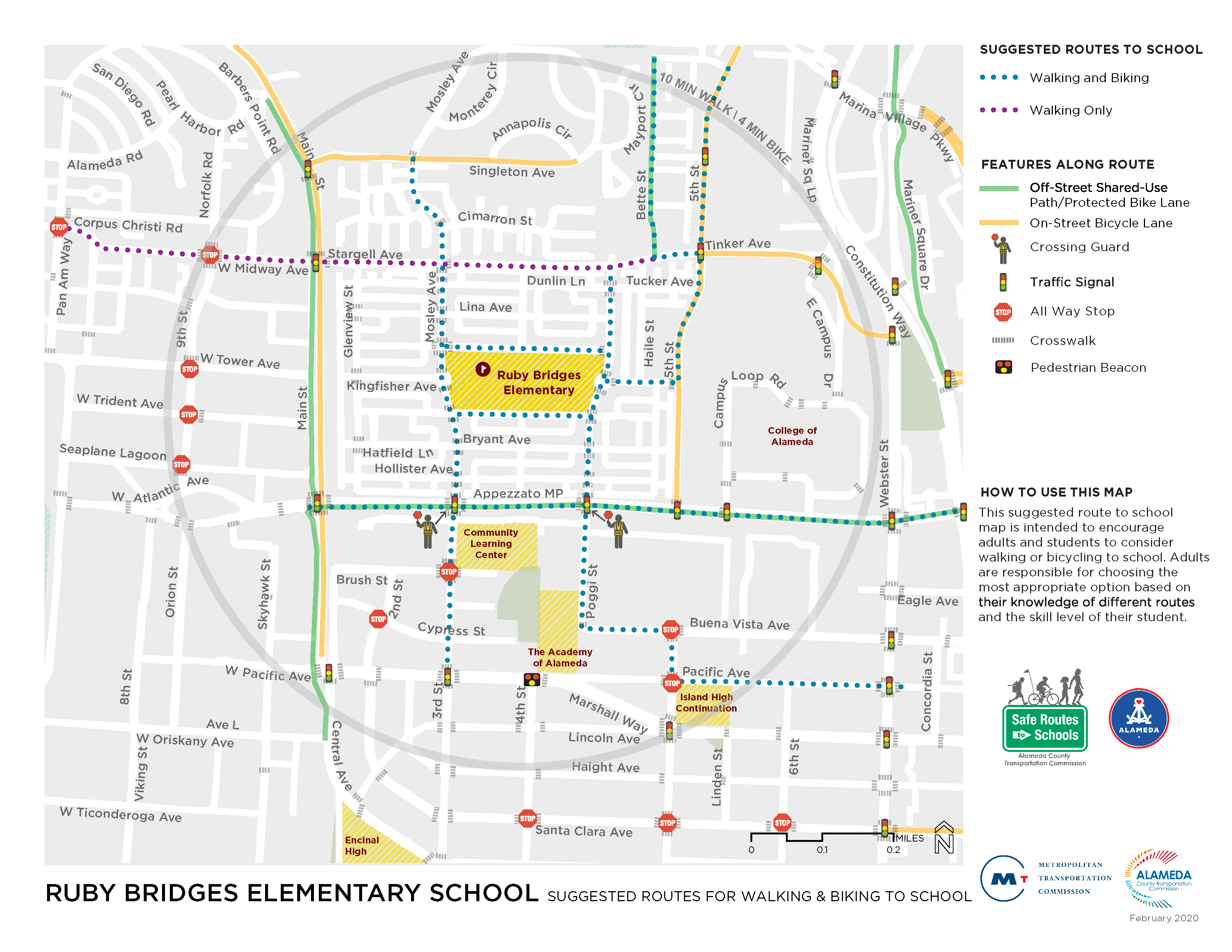
Suggested Routes to School Maps
The Alameda County SR2S Program can develop Suggested Routes to School maps that identify preferred routes to school for walking, bicycling and taking transit. These are based on existing infrastructure like sidewalks and bike lanes or traffic controls/crossing guards for crossing streets.
Suggested Routes to School Maps are intended to be used as a tool for wayfinding, encouragement, and outreach. If appropriate, the maps can be developed to more robustly focus on transit routes and transit education. Maps can include:
- School boundary
- Walking School Bus and Bike Train routes and “stops,” if available
- Highlighted suggested walking/biking routes
- Park and Walk locations
- Key traffic controls
- Bicycle facilities (lanes, routes, paths)
- Pedestrian facilities (sidewalks, trails, marked crossings)
- School access points
- Bicycle parking locations
- Crossing guard locations
- Transit stops (and additional routing and transit education information, if appropriate)
- ½-mile and 1-mile radius buffers
- Average walking/biking times from select locations on the map
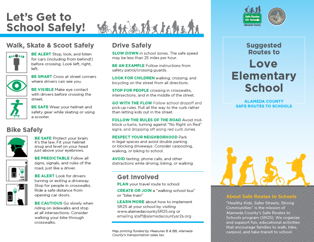
Drop-Off Assistance
The Alameda County SR2S Program can provide drop-off assistance including:
- Identifying Park and Walk locations
- Developing circulation plans
- Staggering arrival and dismissal plans
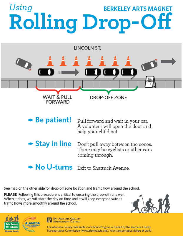
For schools interested in implementing a volunteer-run* rolling drop-off, we can develop printable materials and provide safety equipment to support rolling drop-off activities. A “rolling drop-off” can reduce morning congestion by designating an area for families to let their kids out of the car (with help from a volunteer) without parking or leaving the car. We can create flyers that highlight the rolling drop-off location, preferred vehicle and bike circulation, and tips on how to participate in a rolling drop-off.
*Schools with volunteers identified and ready to implement a rolling drop-off will be prioritized. Our program cannot provide rolling drop-off implementation training at this time.
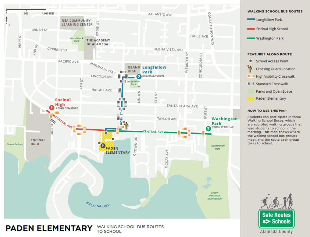
Walking School Bus/Bike Train Route Maps
We can create Walking School Bus and Bike Train Route Maps for developing or existing Walking School Buses or Bike Trains. Maps can include:
- School boundary
- Walking School Bus and Bike Train routes and “stops”
- Park and Walk locations
- Key traffic controls
- Bicycle facilities (lanes, routes, paths)
- Pedestrian facilities (sidewalks, trails, marked crossings)
- School access points
- Bicycle parking locations
- Crossing guard locations
- Transit stops (and additional routing and transit education information, if appropriate)
- ½-mile and 1-mile radius buffers
- Average walking/biking times from select locations on the map